Wildfire Awareness Warning
Since September 1, 2015 the Mississippi Forestry Commission has responded to and suppressed 468 that have burned 4,874 acres across the state of Mississippi.
Wildfire activity destroyed 29 residences, outbuildings, and commercial structures; and damaged 2 additional structures. However, MFC firefighters were able to save 557 threatened residences, outbuildings, and commercial structures from being damaged or destroyed during this time period.
There are currently 33 counties in Mississippi under active burn bans. To see a complete list of burn bans, please click here. Burn bans are subject to change at any time; please check the posted list frequently to stay up-to-date on any new burn bans that are issued.
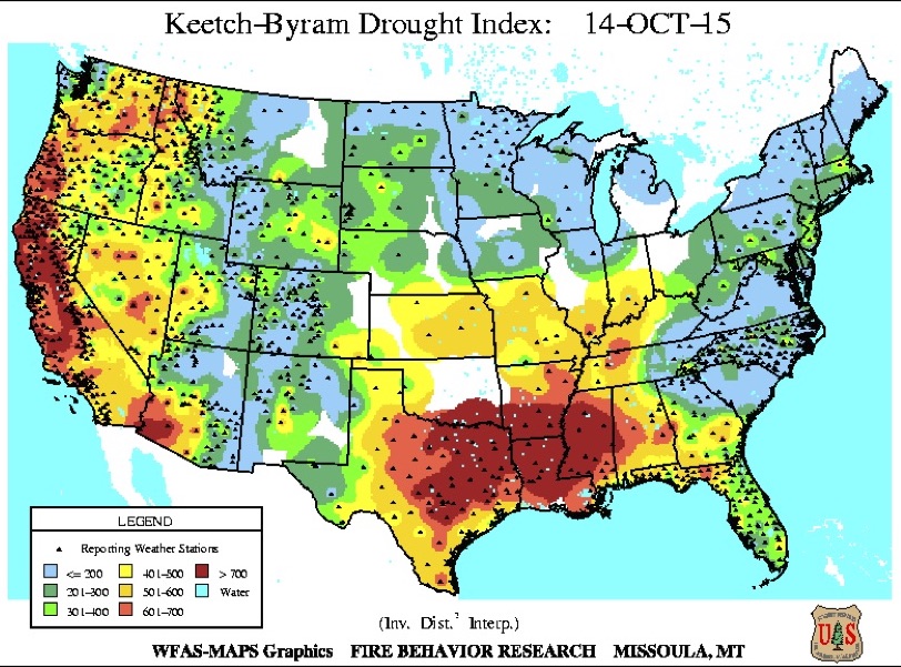
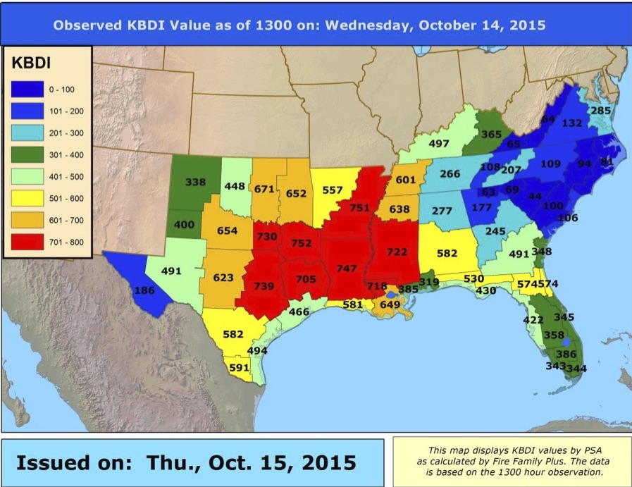
The Keetch-Byram Drought Index (KBDI) is currently > 700 in most areas across the state of Mississippi. The KBDI measures the water content of the soil and duff layers, the scale ranges from 0 – 800 with 800 meaning there is no soil moisture available for vegetation. The index increases for each day an area does not experience rain. High values on the KBDI means that the area is experiencing a severe draught and conditions are favorable for an increase in wildfire activity. In order to view a current KBDI map, click here.
Low humidity and high winds also increase wildfire activity; we would like to ask everyone not to engage in any outdoor burning activities (even if your area is not under an official burn ban) until the State of Mississippi has received an appreciable amount of rain. A small spark can cause a large wildfire when conditions are dry and windy, as they are at this time. Wind carries embers long distances, which can cause spot fires as far away as one-half mile from the burning area. Please do your part to help prevent wildfire activity, and abstain from outdoor burning until conditions improve. In order to report a wildfire, you may contact the Central Dispatch Center for your area, click here to access the full list.
For more information, please visit our website: www.mfc.ms.gov